Meanwhile it's time to finish up this whole series. I drove right by Bears Ears this fall on the way to Natural Bridges. Next time I'm headed that way I hope I can visit both.

It's a small canyon that your drive around the rim in a circle. At various places are trailheads so you can hike down to the floor and see the bridges and other features up close and personal. The bridges were formed by the action of fast moving water, while other features like the spires that are more plentiful at Arches National Park are formed by other kinds of erosive forces like frost and wind.
 |
| Postcard photographers can wait for excellent skies in their pictures. |
The canyon contains several ruins and other evidence of the ancient ones who used to live here. There are rock art and tools from the oldest people and single pueblo structures from the later ones. As with all the other sites where the old ones used to live, no one knows why the just up and moved away.
 |
| On the other hand I had a 100% blue sky day |
 |
| A beautiful day for a drive up Cedar Canyon. |
The monument is not far of of town. I had tried to visit the place on an earlier trip in the spring, but at that time there was still snow all over the place and road to the monument itself was close because of snow. You can get in in winter by using snowshoes, cross-country skis or snowmobiles on a few trails. So I was quite happy that day to have the opportunity to drive in such glorious weather and to be able to get into the place I wanted to see.
 |
| Part of The Amphitheater ... looks a lot like Bryce Canyon |
I found that Cedar Breaks is like a small version of Bryce Canyon. Actually as the snake slithers Cedar Breaks, Bryce and Natural Bridges are pretty much on an east-line line with not that much distance between them. But of course, you can't really get there from there from there because of how the land really is on the ground.
The main attraction is called "the Amphitheater" You drive around the top and overlook this large bowl like area which faces west and is filled with spires, arches, steep canyons and other formations. The rocks are striated in many colors, red, of course, being dominant.
You can't hike down into the amphitheater, but there are some trails on the plateau area on top which go through forest and meadow areas. There are bristlecone pines in the forested areas. Cedar Breaks is yet another "Dark Sky" place.

Down in Arizona and New Mexico, it was volcano land. Petroglyph is volcano country, as are El Maplais, Bandelier, Capulin Volcano and Valles Caldera (all in New Mexico) which I did not have the time to visit. I did visit Sunset Crater Volcano, directly connected to Wupaki ruins just north of Flagstaff.
The monument information says that there are volcano cones all over the Flagstaff area which now form hills. Volcanic areas that are not protected are mined for commodities like pumice or are used for recreation especially with off road vehicles.
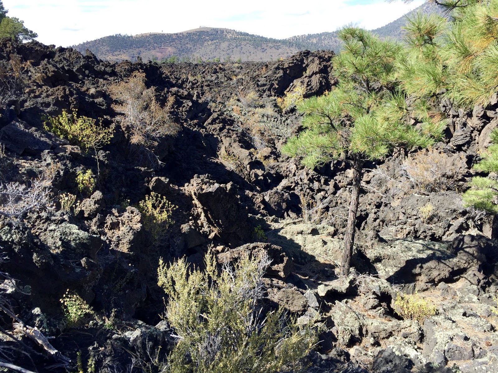 |
| Lava fields are hard to walk in |
The present Sunset Crater Volcano National Monument was the result of citizen activism in the 1920's. Filmmakers wanted to create a landslide, but preservationists objected and won the monument designation. This sequence of events has been repeated several times since then, and I hope it's a national habit we don't lose.
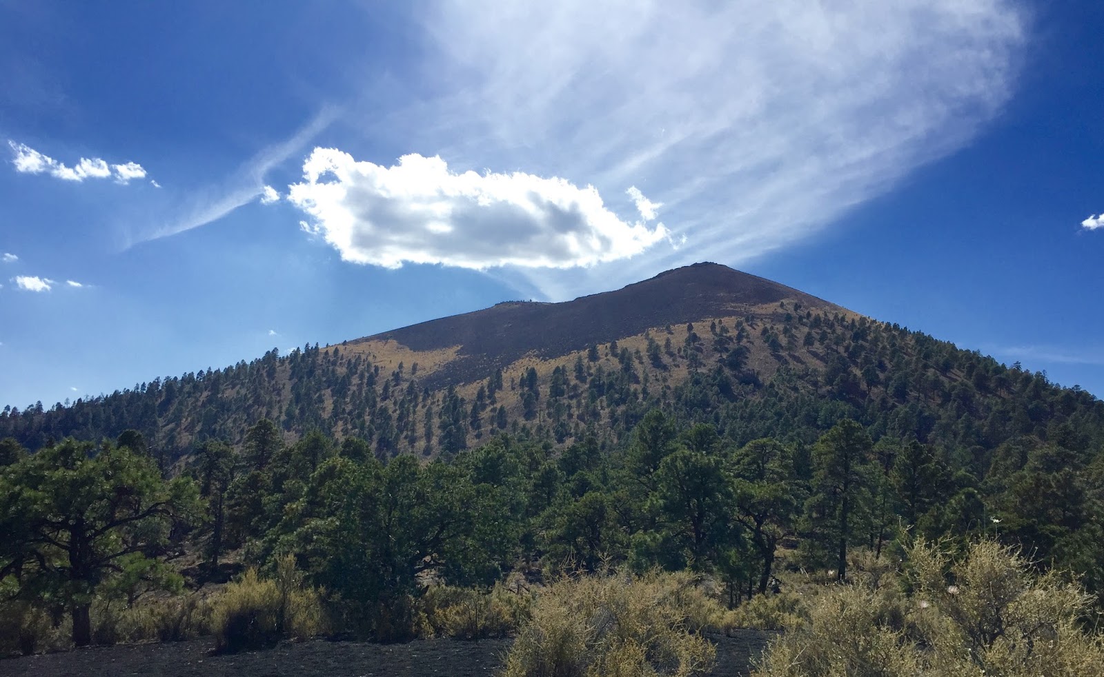 |
| Looks like an ordinary hill, but the surface is fragile. No climbing allowed |
People used to be able to climb the volcano cone, but that caused to much damage, so now there are a few trails and some lava fields near the road that you can get out and explore. Slick, black irregular rock formations make walking difficult, but certainly interesting. Now there are plants poking up through the lava rocks.

Finally I visited Petrified Forest National Park and the connected wilderness area Painted Desert in Arizona. Now this place is something else altogether. The visitor information said that the region was once, long, long ago and far, far away, located near the equator where Costa Rica is now. It was part of the original single continent Pangea.
So you know that story. Time changed things, and now an area which used to be a tropical forest where dinosaurs roamed is a dry high desert. The flora and fauna got all covered up with sediment. The porous trees soaked up water and minerals and over time the biologic matter crystalized and voila! petrified trees.
The park also contains dinosaur and dinosaur era fossils as well as evidence of the early ancestors in the form of petroglyphs, and artifacts like shards and tool fragments.
 |
| Not unlike South Dakota, even the striated colors in the rocks |
The landscape reminded me in general of badlands like in South Dakota. As I drove around I was thinking I had seen these landscapes before .... which I have actually. But then there are these amazing petrified log fragments just strewn about.
 |
| Petrified tree pieces are here, there, everywhere |
This too was an early park, established before Arizona was a state. As is usual, early tourists did not care for the land or its contents at all and just busted up and carted off interesting things wholesale. It seems impossible now, given how western politicians think about the federal government, but in 1895 the territorial legislature petitioned the feds to formally protect the area, and so it was done.
And then this park became one of the places on the original Route 66, as a way to bring more tourists in to see it. One of the original Harvey Houses is here which is now a store and snack shop in the park.
 |
| Too bad the bright afternoon sun kind of washes out the colors |
The Painted Desert is a huge wilderness area located north of the national park, but the nice thing about is that there are overlooks that you can go see directly off exits from I-40. You can get a permit to explore the back country if you want, but like all wilderness areas, you'll be al on your own.
However, the vistas from the overlook areas are fantatsic. Just as you think it would be it's a landscape all filled up with colorful layers in the formations. Well worth the time to just stop off the highway when you happen to be in the area .... following Route 66 maybe.
No comments:
Post a Comment