 |
| The road, the grass, the sky. Welcome to South Dakota, a quintessential red state. |
I asked my friends on Facebook what this new little card could do for me. I got two good replies....one from Josie who said I could now drive like a madwoman, and then David just wrote "Road Trip!" So I decided to combine the two and take a madwoman's road trip.
I got out the map and decided to check out Buffalo, South Dakota, in honor of Sally T. whose home town is Buffalo, New York and who has been blogging recently about all the neat things to do around there. Next time you find yourself in her part of the country, go ahead and use her blog as a tour guide. You'll have a great time. There are lots of things to do in the greater Niagara area, many of them involve getting to eat cheese and/ or cupcakes.
I began the day with a big fill up breakfast at every one's favorite home-style cafe, McDonald's.....in my case, the one located in Sturgis. I figured that this and the one a bit farther up the road in Spearfish would be my last chance for the day to eat out for awhile. I was correct in that assumption.
I took Rte 34 through Whitewood and St. Onge primarily because I had never been to either Whitewood OR St. Onge. Neither one is on the way to someplace else that I usually travel, and I had never taken the time just to go see what they were like. Both had seen livelier days, but both did have abandoned old limestone commercial buildings like this one in St. Onge, which is something, anyway. Whitewood had a 125 year celebration this summer, but I forgot to attend.
 |
| Downtown St. Onge, SD |
There is this nice little roadside park in Buffalo called "Centennial Park." It was designed by a local person to celebrate, guess what? ..... the 100 year anniversary of Buffalo (1909-2009.) That's where I learned most of what I now know about Buffalo and Harding County.
 |
| Here we are in Buffalo, South Dakota. |
The best contender was an established town called Camp Crook, but it was way far west on the Little Missouri River, practically in Montana. So the country fathers decided a new choice was in order. They drew lines to bisect the county on both axis and located the center where there was a whole lot of nothing except grass and sky at the time. They moved the town site a bit so it was on an established stage coach line (the Medora to Deadwood line) and proposed this place as the new county seat, to be called "Buffalo" after the animals, not Sally's hometown, although, of course, by this time, there were no more bison around the area. (You've all heard that sad story, right?)
It took a couple of elections and a fair amount of politicking. No doubt some money changed hands here and there, but in due course Buffalo was it. They built the county building first and eventually the rest of the town around it.
 |
| Modern Harding County Building. I don't know why the flag is at half staff. |
There are no cool old limestone buildings in Buffalo. Neither are there old Victorian mansions .... or even cute old, simple houses .... where the former local big wigs used to live. If such buildings did exist at one time, someone, sometime decided that urban renewal was in order.
All the schools in the county (Harding Country High School Ranchers, colors purple & gold, a class B size school) are there. (A few tiny K-8 schools are located in places with names in various parts of the county. One would be hard pressed to call any of those places "towns" however.) There is a clinic run by the Rapid City system, but no hospital or nursing home. The city has a tiny building, and the volunteer fire and rescue have their place. There is a weekly county newspaper. I did see one sheriff's car out and about. The USDA has a big, nondescript building. Of course there is a post office. There is a fair /rodeo ground, and several rodeos are held throughout the year, mostly high school aged ones.
 |
| Post Office & City Hall. The last building has signs that say it was once a cafe, but it's closed now. |
I saw about 6 churches. The Catholic church seems to be in a ranch style house. This little Congregationalist Church looked the prettiest to me.
 |
| Oh, what a sweet little blue & white church! |
 |
| The local branch of a big bank is into city beautification. |
 |
| Downtown shopping in Buffalo |
 |
| Historic one-room school museum |
Heading out of town you find an "RV park"that was pretty much just parking spaces with a big sign that said "DO NOT LEAVE ANIMAL CARCASSES HERE WHEN YOU GO!" Took me awhile, but I concluded that most of their business must come from hunters.
I was really surprised at how many homes had RVs parked on the property. But maybe that's not so surprising. According the the 2010 census (Wikapedia on the magic Internet machine), Buffalo is a town of older people. The total population was 330 .... 50 fewer than in 2000. Twenty-one percent of the population was under 18, and 18% were over 65. The average age is 44. Forty-nine percent of the population is 45 + years. I can see that the place must be a town of snowbirds. My real question here, though, is why don't the snowbirds just move away altogether? Why bother to come back in the summer? So you can mow some grass? Maybe it's just the pull of "home" whatever home is.
Harding County has two animals of legend. Tipperary was a bucking horse that "no one could ever ride."
 |
| Tipperary is the center of Centennial Park. |
 |
| Statue of the famous brave and clever wolf, Three Toes. |
Harding County itself is pretty much all ranch land. There is a bit of oil drilling in the NW and a bit of crop growing in the east. On the drive up I saw exactly one large field of some crop. It was recently harvested, and my best guess was that it was wheat. It was huge.....a few sections at least put together. I saw no irrigation equipment anywhere.
The land was the beautiful rolling grasslands plus 360 blue sky that I love. I find it hard to photograph this land because it is so expansive and because it's hard to just pull the car over on the highway and stop for a photo. There aren't many turn-offs along the way. No historical markers even.
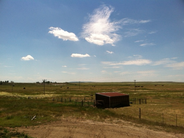 |
| I took this picture in town in Buffalo. It doesn't take much to get away from civilization in these little prairie towns. |
You can see meandering lines of bushes which generally mark natural streams or creeks, and straight lines of trees which are homesteads. However most of the groups of trees no longer shelter buildings (except, perhaps, foundations which you can't see unless you are right there.) It's not difficult to see the short history of while folks in this part of the world even as you drive by at 65 mph.
Lunchtime arrived while I was exploring the signs in Centennial Park. I was glad I had done that big fill up earlier. Thinking about it now, perhaps I should have gone back downtown, to the grocery store and found something there. Maybe I could have returned for a little picnic at the park.
 |
| I quite liked this representation of a river or stream that ran through Centennial Park. It was made with broken blue glass. But I couldn't figure it out because there is not very much of the stuff you would call "water" running through Harding County. Maybe it's the Little Missouri over by the infamous Camp Crook. |
(According the website of Harding County, there is a restaurant over in Camp Crook which is famous for its prime rib. But that's way over on the Montana border, remember? And prime rib on a hot summer's day for lunch? Let's trust they also make sandwiches. Someday, maybe, I'll take a field trip to Camp Crook to see what could have been the seat of Harding County. How exciting will that be? I don't even want to contemplate.)
Decision time! It was about 1:45 PM. Should I just double back and go home or.......? The gas station was at a crossroad with SD Hwy 21. The sign said that road went to BISON, 55 miles. Buffalo AND Bison all in one day! Think of the possibilities! So a left turn heading east it was.
[Continued in Part 2 of this story blog. I'll bet you can hardly wait.]
No comments:
Post a Comment